2015 Fall Miniature Tour de Suisse
Click here for Tour Map
The bucket list for bicycle trips is getting
shorter, well…
As soon as the weatherman predicted a week of
no or just little rain, the planning wheels got set into motion for a quick
cycle tour. An “old” friend of mine had the same idea, so we agreed on a route
with as many mountain passes as possible.
Only a week earlier the temperatures
were hovering in the summerlike 30’s, then overnight fall took over, with temps
only in the upper teens and snow levels dropping down to 1800m. As most passes
are above 2000m, some cooler weather at those elevations had to be expected.
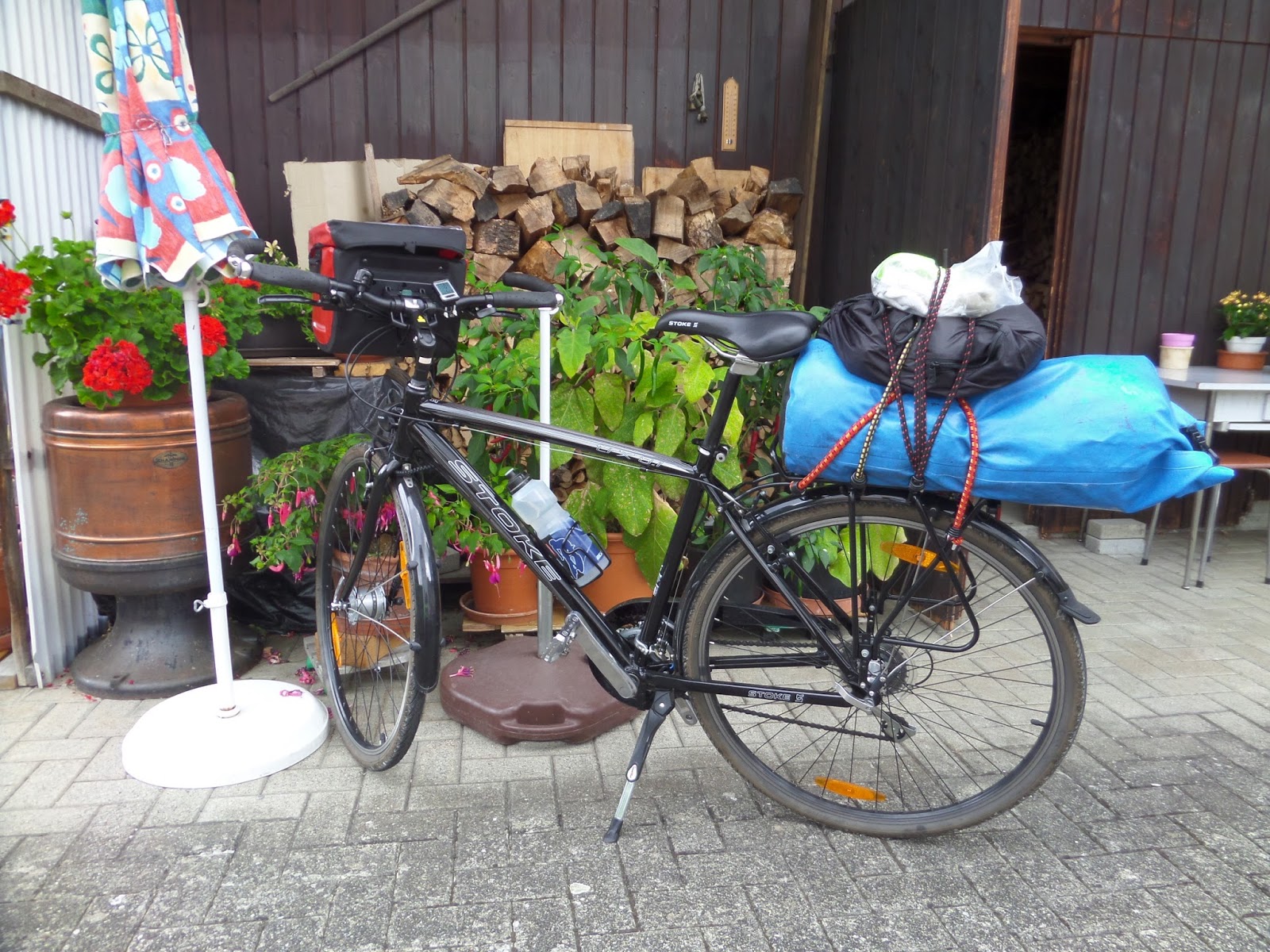
 |
| Ready for another Adventure |
 |
| Sempach | |
Stage
1: Safenwil – Luzern, 48km
I waited until after lunch to leave my mother’s
place, leaving in spite of some dark clouds lingering around. I got to ride on
some wet roads in a neighboring town, as I just missed a passing downpour. The
ride continued through small villages, past farm fields, cattle pastures and
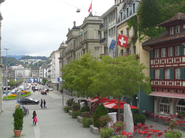
Lake Sempach, before arriving at the suburbs of Luzern. Meeting up with Werner,
we spent time discussing old memories over dinner, as we haven’t seen each
other in a couple of years.
 |
| Luzern | |
 |
| Luzern | |
 |
| Luzern | |
 |
| Luzern | |
Stage
2: Landquart – Zernez, 80km
The following morning we boarded the 06:10
train in Luzern for a 2 hour journey to Landquart, arriving at 08:11 sharp
Swiss fashion timing, from where we started our quest.
 |
| Tunneling |
|
 |
| Trail to Klosters |
|
Leaving town on the bike path which was about
a third of the way paved, we followed the river Lanquart flanked by mountains
on either side. A couple of steep hills of gravel had to be navigated before
reaching the town of Klosters, where the peace and quietness ended as we joined
the main road again. Now the Wolfgangpass of 1637m had to be crossed before
reaching Davos. Although the climb was only a few kilometers, the 12% grade was
a good measuring stick of what was to come.
With the altitude and wind, it had gotten
cold enough to put on arm warmers. Without stopping in Davos, we continued
toward the Flüelapass of 2383m. The grade was pleasant with less than 10% and
the smallest gear got only used in the last kilometer. After taking a few
customary summit pictures, we enjoined a beverage on the veranda of the Hotel
Flüela Hospiz overlooking the Schottensee.
 |
| Road to Fluelapass |
|
 |
| Above the tree line |
With extra clothing and good attitude we
tackled the downhill part to Susch and Zernez for our first overnight stay. How
lovely it was to stay in a hotel and not have to pitch a tent.
 |
| Zernez | |
 |
| Zernez accommodation |
|
 |
| Breakfast wagon |
|
Stage
3: Zernez – Grosotto, 103km
The morning buffet was superb and knowing the
amount of calories to be burnt during the day while riding, we got our money’s
worth. As we got going after breakfast, following the Spӧl River, the
thermometer only read 3 degrees. A bit chilly, but the road started to climb
pretty quickly after leaving town, which turned on the internal furnace. It was
still a bit nippy riding in the shade of the trees, but as we got to the sunny
spots, it felt perfect. After about 10km we could relax, cruising downhill for
a while before tackling another uphill to the summit of the Ofenpass of 2149m.
On the way up we passed the only National Park of Switzerland, although we
didn’t stop for any excursions.
We refrained from refreshments after taking
our pics, but put on some extra clothing and hurried down to Santa Maria. 800m
below it was warm enough to sit outside on the veranda to enjoy some coffee and
bring up the body’s core temperature again.
 |
| Santa Maria |
|
 |
| Santa Maria |
|
 |
| Santa Maria |
|
 |
| Tractor for Overhanging Slopes :) |
Right from the town center, the road has a
grade of 8 – 10% toward the Umbrailpass. After 33 switch backs and 1121m of
climbing, we reached Switzerland’s highest pass of 2503m. Now we were only a
stone’s throw away from the Italian border and its highest pass the Stilfserjoch of 2757m. The summit restaurant can be seen from the Umbrailpass and is
only a few kilometers away. The extra effort was well worth it, as the view
from the top was just stunning.
 |
| Santa Maria in the Distance |
 |
| Climbing Umbrailpass |
|
 |
| More Switch-Backs |
 |
| Success | |
Very cold and rather commercialized, which
took away some of the excitement, we continued now on Italian roads. After 21km
of downhill and countless switch backs we arrived in Bormio 1540m below. Warm enough
again to ride in short sleeves, following the river Adda, we then ended up in
Grosotto for another overnight stay. Just crossing the border made for everything
a bargain. Accommodation and food was half the price of Switzerland and our
beloved Espresso was on only 1€, a quarter of the price.
 |
| Commercial Stilfserjoch |
 |
| Alpengasthof Tibet |
|
 |
| Incredible Road to the Stilfserjoch |
|
 |
| More Switch-Backs down to Bormio |
Stage
4: Grosotto – Bergün, 95km
Knowing we would have another full day ahead
of adventure, we took advantage of the extended breakfast buffet and filled our
bellies.
 |
| Grosotto Accommodation |
|
 |
| Street of Grosotto |
|
 |
| Grosotto | |
 |
| Grosotto | |
Slightly stuffed we were gladly rolling
downhill following the river Adda, through picturesque sleepy little Italian
villages, past apple orchards and with views of vineyards on the hills in the
distance. Reaching bottom in Tirano, down to almost 400m elevation, we knew it
would be a challenging climb of close to 2000m to the Berninapass of 2330m.
There just wasn’t enough time to stop in
every town, but Tirano can be put onto a re-visiting list.
 |
| Tirano | |
 |
| Hills with Grape Juice in the making :) |
 |
| Tirano | |
Leaving the city toward the Swiss border, the
road is shared with the Rhaetian Railway, a rather unusual sight. The Railway
crosses the Berninapass as well and sports the highest rail crossing in
Europe. As the train tracks separated
from the road, the 35km plus incline started. Reaching Lake Poschiavo was not
only scenic, it was also a relief from the uphill pedaling as the road leveled
out, which continued until the town of the same name.
 |
| Train to Berninapass |
|
 |
| Back to Switzerland |
|
 |
| Laka Poschiavo |
|
|
 |
| Poschiavo | |
 |
| Poschiavo | |
After some sightseeing and refreshments in
Poschiavo, it was back to the business of pedaling. This mountain pass is well
travelled, more than the previous ones, but the road is wide and it felt safe
to ride next to other road users. Toward the summit it was steep enough again
to use the smallest gear. Piz Bernina with its glacier in sight kicked in the
adrenaline and catapulted us to the top.
 |
| Piz Bernina |
|
 |
| Bernina Pass Resting Place |
|
After more refreshments and warming up in the
mountain restaurant, some more layers of clothing were added before the
downhill run to Pontresina. A few more easy kilometers following the river Inn
along the valley floor gave us some more time to rest up before the next climb.
In La Punt we made a left hand turn toward the Albulapass. The first 4km were
narrow and steep and only a short 5km later the summit of 2315m was reached. Although
cold, it was a comfortable ride with the lack of traffic and only a few
motorcycles sharing the road.
 |
| Swiss Chocolate in the Making |
|
 |
| Road to Albulapass |
|
 |
| Albula | |
Earlier a police roadblock with spikes and
assault rifles in hand near the bottom of the Pass caused a little excitement,
but at a speed 10km/h we must not have been seen as a threat and passed without
incident.
A quick downhill run got us to Bergün, where
we found shelter at the Hotel “Weisses Kreuz”. A customary arrival beverage,
followed by cleaning up and dinner, concluded another day.
 |
| Berguen | | | | |
 |
| Berguen Accomodation |
|
 |
| Berguen | |
 |
| Berguen | |
Stage
5: Bergün – Andermatt, 126km
Another morning with fresh mountain air
coming in through the open widow, I as always was looking forward of getting up,
with breakfast on my mind. Coffee, fresh breads, croissants, jams, cheeses,
cold cuts, cereals, fruits… ahhh, I just love those morning hours!
Soon though in the saddle again, we headed
downhill through chilly canyons at neck-breaking speeds to Tiefencastel.
 |
| Drink more Wine |
|
 |
| Versam |
|
From
Bonaduz we followed the road to Versam and Ilanz high over the River Rhein with
spectacular views over the gorge. Biking on a narrow road with hardly any
traffic, we took lots of time to stop and enjoy the scenery.
 |
| Road to Valendas |
|
 |
| Old Rhein Bridge |
|
The village of Valendas greeted us with a
closed roads sign, as preparations were in progress for a movie set about the
Gotthard Tunnel. Paved roads got covered
with gravel for authentication of past times. Slowly we pedaled past the sets,
but did not get recognized as future stars!!
 |
| Valendas | |
 |
| Set Preparation |
|
 |
| Valendas | |
 |
| Valendas | |
Dark clouds continued to build up overhead
and before Disentis finally for the first time this week, they broke and poured
some wet stuff on us. We stopped to wait at a gas station for the showers to
pass, had some snacks and continued in a slight drizzle.
 |
| Bridge from times passed |
 |
| Disentis | |
 |
| Sedrun | |
Soon the roads dried
up as it got a bit steeper toward Sedrun, where the new Gotthard Base Tunnel is
passing below. (With a length of 57km, it is the world’s longest and deepest
traffic tunnel.)
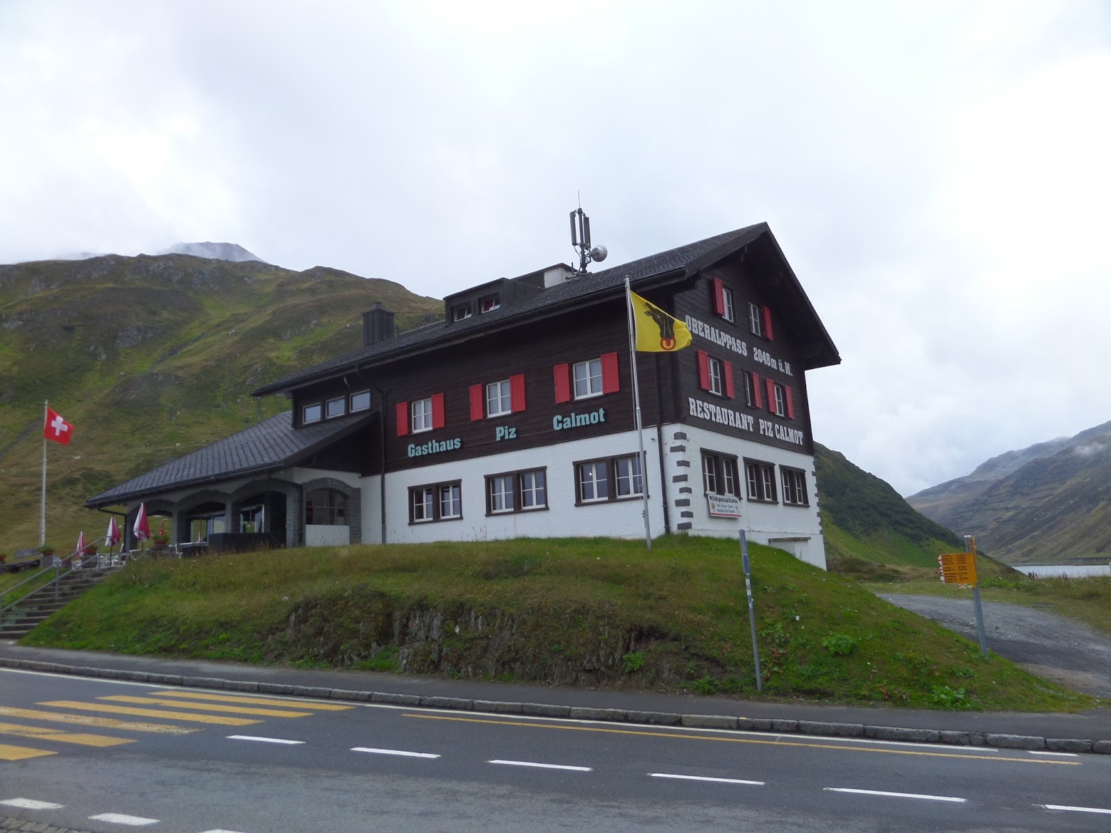
Then a bit steeper again for the last 6km as we
conquered the Oberalppass of 2046m slightly wet.
 |
| Down to Andermatt |
|
As reward for the effort, we settled into the
Gasthaus Piz Calmot to warm up with coffee and one of my favorite Swiss desserts
Vermicelle a la mode. As the fog started to move in, we packed up and directed our
handlebars downhill. Just in time we arrived in Andermatt as the rain started
again and settled into a room at the Hotel Badus, after the longest ride so
far.
 |
| Favorite warming hut |
|
Stage
6: Andermatt – Luzern, 123km
At 1500m elevation it was a nippy start.
Heading out toward Hospental it was slow going, because of a cold headwind
blowing into our faces. Luckily the wind subsided getting further up the
valley, to a great relief to our minds. So far headwinds have not been of any
nuisance, unlike on other bicycle trips.
 |
| On the Road to Realp |
|
 |
| Realp | |
From Realp double digit grades were leading
us up the switch backs for about 6km. As the road was leveling out a bit, there
was a good view of the valley below and the nostalgic Furka Steam Railway
crawling up the canyon. The line first operated in 1925 and is the second
highest rail crossing after the Bernina Railway.
The snowplows parked on the side of the road were
also sign of the approaching winter season.
 |
| Realp in the Valley below |
 |
| Waiting for White Stuff |
|
 |
| Steam Train |
|
Not before long there was some snow next to
the road and with the fog moving, it made the scenery beautiful, but it got
shivering cold as well. The last km leading to the summit got steeper again, so
we had to utilize the granny gear, before reaching the 2436m Furkapass.
 |
| On the way to Furkapass |
|
We
only spent enough time to take a few pictures before speeding down to the next
restaurant for a warm up coffee and my daily dose of Swiss Pastry the
Nussgipfel. Our window table had a gorgeous view of the valley below and the
switch backs leading up to the Grimselpass.
 |
| View of Grimsel Road |
 |
| Cozy Cafe on Furka |
Back on the road and after a few pedal strokes
the village of Gletsch was reached, which is the junction to either downhill to
the canton Wallis,or uphill to Bern. Turning uphill, half dozen switch backs
and 6km later, the Grimselpass of 2165m was reached. Looking back from the serpentines,
the massive Rhone Glacier can be seen as well as the twisting road coming down
from the Furka Pass.
 |
| Totensee Grimselpass |
|
The Grimselpass road is wider and better
established than Furka - Oberalp Passes, which turns into more traffic
commercial & private. A lot of the vehicles are also of foreign origin and
included some aggressive bus drivers. Speeding downhill we were able to keep
clear of those vehicles as we outpaced them with a top speed of 85km/h.
Scanning about while riding, not only the beautiful countryside could be seen,
as well as remnants of old roads and bridges left in place from the past.
 |
| Down Grimsel toward Innertkirchen |
 |
| Bridge with Stories to Tell |
Once we got below the tree line, we received
better protection from the elements. The temperature increased and by the time
we reached Innertkirchen with 625m elevation, riding in short sleeve became
fashion again. Now there was only the Brünigpass of a mere 1007m in front of
us. Although a short 6km from Meiringen, the 9 – 13% grade took some effort and
steady passing traffic made this the least favorable stretch of road.
 |
| Last Pass |
|
We rewarded ourselves by sitting down in the
sunny garden restaurant for a refreshment. For the downhill we stayed away from
the main road and enjoyed a quiet ride on a bike path to Lungern.
 |
| Refreshment Stop |
 |
| Lake Lungern |
|
Along Lake Lungern and Lake Sarnen we made it
to Alpnach Dorf where we had one more unscheduled coffee stop to leave a
passing downpour the right-away.
Back in Luzern, one last meal was shared
recounting the past few days.
Stage
7: Luzern – Safenwil, 49km
After my good-byes with Werner and retracing
old tracks, soon Safenwil the village of my childhood was back in sight and
concluded a week of cycling.
 |
| My Zoo :) |
 |
| Peaceful Countryside |
 |
| Swiss Graffiti |
|
 |
| Swiss Graffiti |
|
It was another successful trip, as clean
swept roads all over gave no opportunity for any objects to puncture the tires.
The wind gods were mostly in our favor, no
pesky bugs and I always felt safe riding among other road users.
Until
next time from …..?
Tony
Bike